

Florida Trail Association - Loxahatchee Chapter
Ocean to Lake Hiking Trail
Important Reminder for all: When conditions are dry, WATER is not always available. PLEASE BE AWARE. |
 The Ocean to Lake Hiking Trail
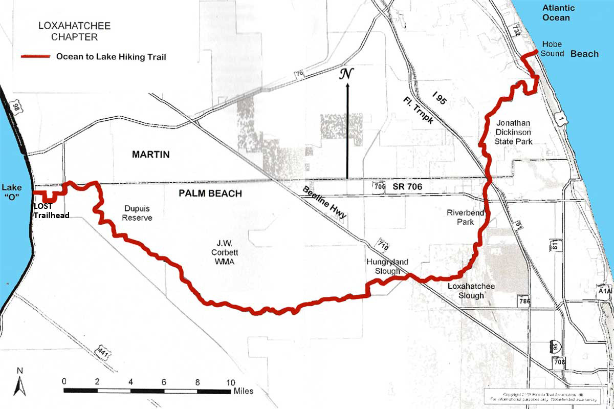
Maintaining, developing, promoting, and improving the Ocean to Lake Hiking Trail (OTLHT) is one of the responsibilities of the Loxahatchee Chapter. The trail runs for approximately 61.4 miles, west from Hobe Sound Beach to Lake Okeechobee where it ends at the Lake Okeechobee Scenic Trail (LOST) trailhead, which is approximately two and a half miles south of Port Mayaca. The trail starts at the ocean, entering Jonathan Dickinson State Park at US 1, traveling through the park, Palm Beach County Natural Areas, Corbett Wildlife Management Area and Dupuis Management Area, and ends at the lake. The ecosystems on this beautiful trail change approximately every mile, from ancient sand dunes with scrub oak and sand pine to pine flat woods, palmetto and oak hammocks, cypress swamp and wet prairies. A map is available through the main FTA office.
Click here to download PDF of the OTLHT data sheet (updated 7/15/23).
We have downloadable maps of each section of the trail thanks to Bill Evans. These are PDF files that are formated so they can be printed on an 8-1/2" x 11" sheet of paper or stored on your phone or other device. Click on the map name to download.
Map 1- overall map
Map 2- DuPuis
Map 3- Corbett
Map 4- Riverbend
Map 5- Jonathan Dickinson State Park
A pdf listing of End to End participants who have submitted info (updated Jan '26.) OTL End to end2025
A number of annual hiking and running events use this continous trail. Except for short segments, routed on sidewalks, roads or canal banks, the trail is for foot traffic only. There are a number of access points to the trail but none are recommended for overnight parking. The access points include: the parking lot at Hobe Sound Beach, Highway US 1 at NE corner of Jonathan Dickinson State Park, several points inside Jonathan Dickinson (these require hiking on other trails to connect with the OTLHT), the parking lot at River Bend Park, the crossing with Beeline highway near Palm Beach County airport, the south entrance to Corbett Wildlife Management Area, and the LOST trailhead at Lake Okeechobee.
Sections of the trail may be closed for hunting, prescribed fire burns, agency maintenance, and possibly other reasons. Some sections are open only for specific times or daylight hours and some do not permit overnight camping or open fires. Pets are not allowed on Hungryland Slough, Loxahatchee Slough and Riverbend Park.
There are fees for access to Jonathan Dickinson State Park and the Corbett Wildlife Management Area. Please contact the appropriate agencies to make sure their section of the trail is open to the public. Click here for a pdf list of the contacts for the different areas of the trail. Updated 7/15/23
The Everglades Youth Camp is not a designated stop nor camping location for OTLHT hikers.